Graphic


This page has not been translated into Español. Visit the Español page for resources in that language.
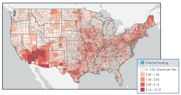
The Resilience Analysis and Planning Tool (RAPT) is a free GIS web map that allows federal, state, local, tribal and territorial emergency managers and other community leaders to examine the interplay of census data, infrastructure locations, and hazards, including real-time weather forecasts, historic disasters and estimated annualized frequency of hazard risk.
View the Community Resilience Indicator Analysis (CRIA), the underlying Indicator Analysis in RAPT.
Resilience Analysis Tool