
States
Leadership
Environmental Resources
Mitigation Planning
Contact Us
News
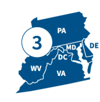
FEMA's Region 3 office, located in Philadelphia, PA, partners with federal emergency management for seven Tribal Nations and the following states.
States
Visit the state/territory's page for localized content, such as disaster recovery centers, flood maps, fact sheets, jobs and other resources.
Leadership

Acting Regional Administrator
Acting Deputy Regional Administrator
Environmental & Historic Preservation Resources
FEMA funded projects must undergo Environmental and Historic Preservation (EHP) review to ensure we protect and preserve our natural and historic resources.
These tools help explain the federal environmental and historic resource laws and Executive Orders. They provide guidance specific to Region 3 states for the EHP compliance portion of the grant application process.

EHP Checklist
Use the EHP Checklist to learn what's required to complete an EHP review, plus common reasons for additional requests for information.
EHP Photo Guide
Learn how to take photos that help EHP understand your project and reduce additional requests for information.

Environmental Assessments
View Region 3 documents, including draft and final environmental assessments and public notices.
Video Tutorials
View these short, easy-to-understand 15-minute videos to learn the basics about the EHP review.
Have EHP Questions?
Contact Federal, State & Tribal Governments
Find contact information for federal and state partners and tribal nations that work alongside Region 3 EHP as applicant liaisons and consulting agencies during environmental and historic preservation law reviews.
NOTE: This list was updated as of Dec. 2022 and should not be considered a complete list.
Contact EHP
Hazard Mitigation Resources
The resources below can help your state or community develop a hazard mitigation plan, request technical assistance, find flood information, and use mapping tools to reduce risk.
Visit the Region 3 Mitigation GIS and Data Hub for maps and data that support hazard mitigation.
Topics
Use the search filters below to find resources on:
- State and local hazard mitigation planning
- Planning for high hazard potential dams
- GIS tools for reducing flood risk
- Training and technical assistance opportunities
National-Level Resources
Request Training
Review the Hazard Mitigation Course Catalog for information on all of the external training courses currently available through FEMA R3.
Fill out this contact form to request training or technical assistance for your community.
For communities with FEMA Flood Risk Products, this instruction sheet describes how to use the Depth and Analysis Grids to find structures with the highest chance of flooding over 30 years. You can use the results to inform outreach to residents in areas with high flood risk.
For communities with FEMA Flood Risk Products, this instruction sheet describes how to use the Depth and Analysis Grids to identify the roadways and evacuation routes with the highest chance of severe flooding. You can use the results to prioritize transportation infrastructure projects in your mitigation action plan.
For communities with FEMA Flood Risk Products, this instruction sheet describes how to use the Depth and Analysis Grids to identify areas where clusters of buildings are at the greatest risk of severe flood damage. You can use the results to identify cost-effective infrastructure projects that are more likely to receive grant funding.
For communities with FEMA Flood Risk Products, this instruction sheet describes how to use the Depth and Analysis Grids to identify open space parcels that are likely to be developed and have a high chance of severe flooding. You can use the results to prioritize areas for conservation.
This instruction sheet describes how to use National Flood Hazard Layer data along with local elevation data to find the areas where flood risk is likely to rise first with climate change. You can use the results to inform planning or regulatory actions that reduce future flood risk.
For communities with FEMA Flood Risk Products, this instruction sheet describes how to use the Depth and Analysis Grids to identify critical facilities (such as schools and fire stations) with the highest chance of severe flooding. You can use the results to identify cost-effective structure and infrastructure projects that are more likely to receive grant funding.
Connect with Region 3
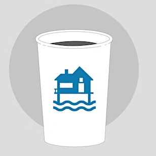
Coffee Break Webinars
Attend a Region 3 “Coffee Break," a one-hour webinar showcasing mitigation best practices and highlighting the work to reduce risk across the region. Reserve a spot.
Resilience Report Newsletter
Sign up to receive project highlights, best practices and upcoming events focused on mitigation, risk reduction, and increasing resilience.

Regional Business Emergency Operations Center
Region 3's Business Emergency Operations Center helps connect FEMA and the private sector throughout pre-disaster preparedness, disaster response and post-disaster recovery. Learn more and join.

Region 3 Case Studies
View case studies sharing successes and lessons learned from Region 3 states.
Recovery Forward Newsletter
Sign up to the Recovery Forward Newsletter.
Contact Us
General
215-931-5500
Congressional
FEMA-R3-CongQ@fema.dhs.gov
Exercise Officer
FEMA-R3-Exercises@fema.dhs.gov
Grants
FEMA-R3-Grants-Division@fema.dhs.gov
News Desk
215-931-5597
FEMAR3NewsDesk@fema.dhs.gov
Private Sector
FEMA-R3-Private-Sector@fema.dhs.gov
Tribal Affairs
FEMA-R3-Tribal@fema.dhs.gov
Hazard Mitigation Planning
fema-r3-hm-planning@fema.dhs.gov
Flood Insurance
FEMA-R3-NFIP@fema.dhs.gov