FEMA In Your Community Stories
Environmental Planning and Historic Preservation
Risk Map
Flood Mapping Projects
Leadership
Contact Us
News
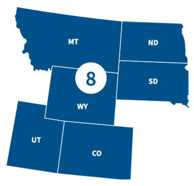
FEMA Region 8 office, located in Denver, Colorado oversees federal emergency management for 29 Tribal Nations and the following states:
FEMA In Your Community Stories
FEMA Region 8 staff are working every day to support our six states and 29 tribal nations. We provide needed support to communities that have suffered from disasters, but there are also numerous other activities you may not even know that FEMA is involved in. Here, you can learn more about what we are doing in your community. You can also follow us on Twitter and look for the hashtag #FEMAIYC.
Oct. 18, 2021
FEMA Shares in Hart Award Win
August 23, 2021
Reading, Writing, Arithmetic... and Mitigation
View Archived FEMA In Your Community Stories
Environmental Planning and Historic Preservation
Potential impacts to the environment and cultural resources must be considered when a community applies for FEMA funding through Public Assistance, Hazard Mitigation Assistance and Preparedness Grants.
- Find resources to help conduct an environmental and historic preservation review
- Get guidance for grant applications
- View listings of regional environmental assessments and notices
Risk Mapping, Assessment and Planning (Risk MAP)
Risk Mapping, Assessment and Planning (Risk MAP) is a national FEMA program that works with states, tribes, territories and local communities to evaluate and better understand their current flood risk, as well as the actions that can be taken to mitigate and become more resilient against future risk.
- Learn about the Risk MAP program
- Find location-specific project information using Risk MAP products, which provide user friendly analysis of flood risks
Publications
FEMA Region 8 has developed a number of documents to provide useful information to the public on topics such as hazard mitigation and emergency preparedness. The region also creates reports and studies following major disaster events.
View Publications
NFIP Flood Mapping Projects
FEMA works with communities throughout Region 8 to update and improve flood maps to provide the best flood risk information available. This allows communities and individuals to make informed decisions regarding where and how to build in a way that protects lives and property.
One of the final steps in the mapping process is a release of preliminary maps for all in the community to review. With this release, there is a 90-day appeal period, during which community members can appeal flood hazard information that they believe is in error.
Appeal packages must be submitted during the 90-day appeal period. Appeals must have supporting scientific or engineering data that show the information on the preliminary maps to be incorrect.
View 90-day appeal periods on the individual state pages.
Visit FloodMaps for futher details on the process.
Preliminary mapping also may be viewed on FEMA’s Map Service Center.
Leadership

Nancy Dragani
Regional Administrator
Nancy Dragani is the Regional Administrator for FEMA Region 8. Ms. Dragani leads and coordinates all activities in support of FEMA’s mission with the states of Colorado, Montana, North Dakota, South Dakota, Utah and Wyoming, and also with the 29 federally recognized tribes within the region.
Nancy Dragani Full Bio

Ryan Pietramali
Deputy Regional Administrator (Acting)
Mr. Ryan Pietramali joined FEMA in 2007 and is currently detailed to serve as the Acting Deputy Regional Administrator for FEMA Region 8.
Ryan Pietramali Full Bio