
The National Inventory of Dams (NID) documents all known dams in the United States and its territories that meet certain criteria. It is designed to provide a variety of users the ability to search for specific data about dams in the United States and serves as a resource to support awareness of dams and actions to prepare for a dam-related emergency.
The U.S. Army Corps of Engineers (USACE) is responsible for maintaining the National Inventory of Dams and works in close collaboration with federal dam regulating agencies, including the FEMA and federal and state dam regulating agencies, to obtain accurate and complete information about dams in the database.
The database contains information about a dam’s location, type, size, purpose, uses and benefits, date of last inspection, other structural and geographical information and much more.
There are more than 70 data fields for each dam. The also used to assist federal, state, and local agencies develop dam safety policies.
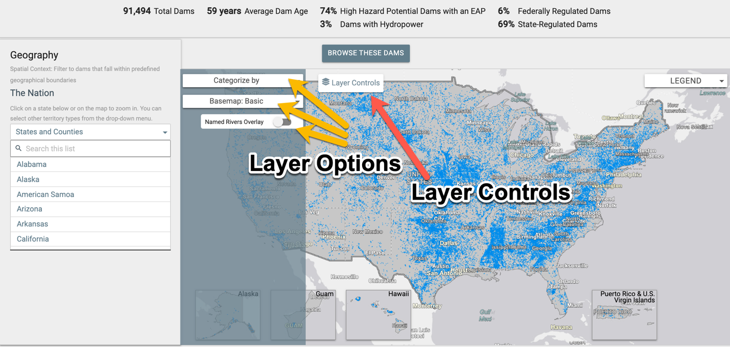
Explore the National Inventory of Dams
Updates from the National Inventory of Dams
The NID is the central information source for dams in the United States and its territories. Recent updates to the site support a wider variety of users, such as emergency managers, safety professionals, infrastructure owners, community leaders, business owners, and residents, understand the relationship between dams and their surrounding communities. The new features include:
- Public sharing of dam flood inundation maps (initially USACE only)
- Real-time data input and download
- User-friendly search functions
- Learning center for additional dam-related resources
- Additional information to explain benefits and risks of USACE dams
Information in the National Inventory of Dams
Initially consisting of approximately 45,000 dams, the United States now has 92,075 total dams with an average age of 61 years. Since continued and methodical updates have been conducted, data collection has focused on the most reliable data sources, the many federal and state government dam construction and regulation offices.
The database contains more than 70 data fields for each dam. This includes the dam’s location, size, purpose, type, last inspection, and regulatory facts. Additional information is available for some dams such as a general description of the dam, summary of known issues, and planned actions to address them. Maps that show possible flooding near dams, also called flood inundation maps, are available for some dams. These maps show where water may go if a dam-related issue occurs and can help those living and working near dams take protective actions.
Today, the database contains information for more than 91,000 dams that meet the following criteria:
- Dams where downstream flooding would likely result in loss of human life (high hazard potential).
- Dams where downstream flooding would likely result in disruption of access to critical facilities, damage to public and private facilities, and require difficult mitigation efforts (significant hazard potential).
- Dams that meet minimum height and reservoir size requirements, even though they do not pose the same level of life or economic risk as those above – these dams are typically equal to or exceed 25 feet in height and exceed 15 acre-feet in storage, or equal to or exceeding 50 acre-feet storage and exceeding 6 feet in height.
Visit the National Inventory of Dams page for the dams and flood inundation maps information.
Visit the NID Video Page for Flood Inundation Map Video. This video describes what dam flood inundation maps are, how they can be used, and where more information can be found.
History of the National Inventory of Dams
Congress first authorized the U.S. Army Corp of Engineers to inventory dams in the United States with the National Dam Inspection Act of 1972. The NID was first published in 1975. Most recently the inventory was reauthorized as part of the Water Resources Reform and Development Act of 2018.
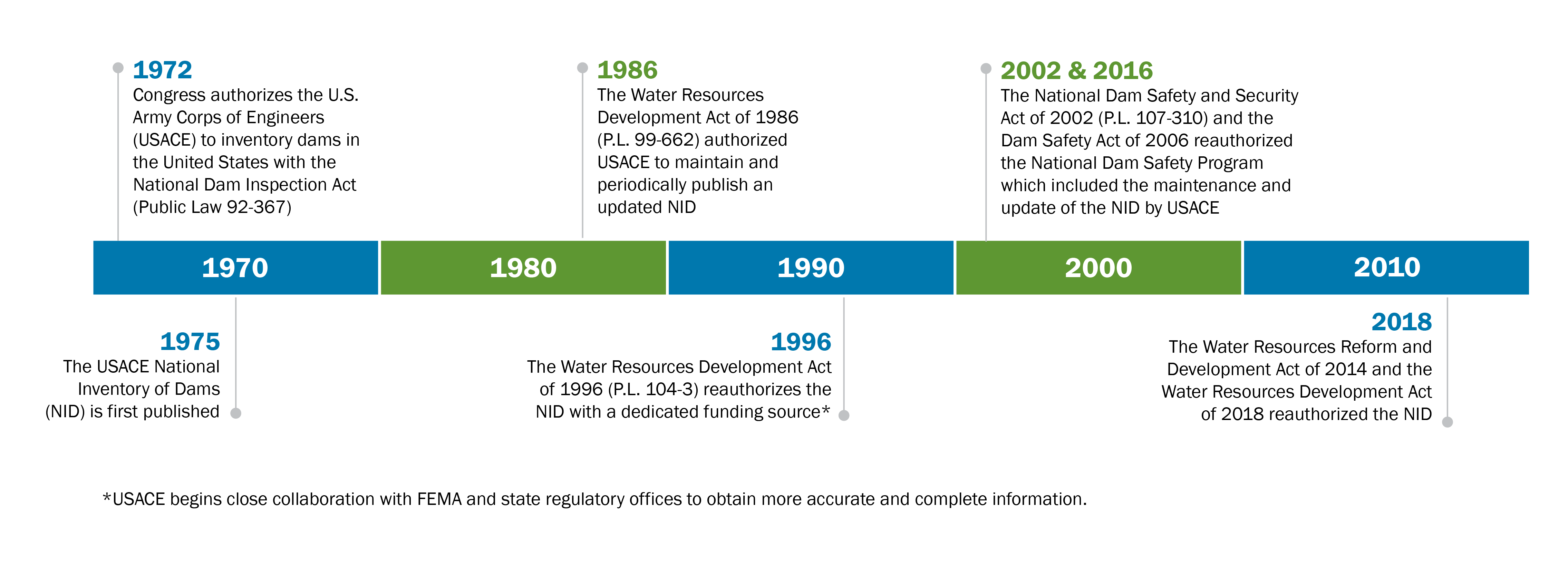
For more information, visit the “A Closer Look at the NID” section of the U.S. Army Corps of Engineers' National Inventory of Dams webpage.
For any issues or questions regarding the NID, contact the NID Data Team.