
FEMA Media Library

Mini Illustration for Flood Maps Flood Zones Steps - 1


illustration featured coronavirus high school icon

East Ward Technology Center Relocation, Harrison County, Mississippi (May 2007)
Feature - YouTube
Procedure Memorandum 37: Protocol for Atlantic and Gulf Coast Coastal Flood Insurance Studies in FY05 (Aug 2005)
STORM Program Phases Process
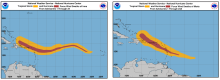
National Weather Service Maps - Hurricanes Irma and Maria 2017

KPF Chemical - Figure 82

Final FONSI
Emergency Support Function #5 – Information And Planning Annex
Emergency Support Function (ESF) #5 — Information and Planning collects, analyzes, processes, and disseminates information about a potential or actual incident, and conducts deliberate and crisis action planning activities to facilitate the overall activities in providing assistance to the whole community.